Many drone manufacturers and end-users share a common misconception: that as long as the gimbal’s stabilization performance is sufficient, image quality is guaranteed.
While a gimbal can effectively suppress angular jitter in the roll, pitch, and yaw axes, it struggles to fully compensate for minute displacements in the vertical direction. These micro-oscillations are the primary culprits behind focus failure, motion blur, and difficulties in post-production stitching.
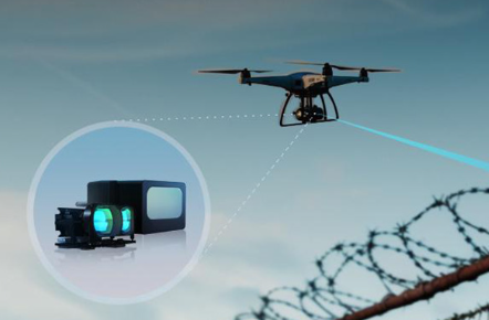
Solving this requires accurate, real-time altitude sensing. Drone LiDAR provides exactly that, and this article uses Benewake TFA300 LiDAR as an example.
Maintaining Stable Flight Altitude
- Focus and Resolution Issues
To understand how drone LiDAR improves imaging, we first look at how vertical instability affects it:
(1) Focus Hunting
Traditional barometers are prone to errors caused by airflow and temperature, causing the drone to drift vertically by tens of centimeters.
The camera misinterprets these altitude shifts as changes in target distance, triggering constant autofocus (AF) adjustments. This focus hunting often results in blurred frames at the exact moment of capture.
(2) Ground Sample Distance (GSD) Consistency
When a drone fails to maintain a consistent height, it leads to fluctuating GSD, where the same object appears at different scales across various images.
Post-processing software may stretch or crop images to align them for stitching, causing significant interpolation loss and degrading the native image quality.
- How Benewake Drone LiDAR Solves
Both issues stem from unstable altitude estimation.
Benewake LiDAR provides high-precision (centimeter-level) altitude measurements under typical operating conditions and is less sensitive to air pressure and temperature variations.
The camera control or autofocus system can utilize these accurate distance measurements to reduce unnecessary focus adjustments and improve overall imaging stability.
In addition, by supplying reliable real-time altitude data, LiDAR enables the flight control system to maintain a more consistent flight height. This helps ensure stable GSD across captured images.
Enhancing Ranging Accuracy
1. Accurate Ranging Challenge on Small Targets
Conventional LiDAR sensors often have large beam divergence. For instance, at 10 meters, a typical wide-beam LiDAR might produce a 0.5m-diameter footprint. As a result, the measured distance may reflect a mix of the target and its background, rather than the target’s exact position.
When imaging small objects, such as 5–10 cm power lines, bridge cables, or narrow structures, this deviation can cause the reference distance to shift away from the actual target. This often leads to focus errors, where the camera may lock onto the background instead of the intended subject, resulting in blurred foreground details.
2. Benewake Drone LiDAR Advantage
The Benewake TFA300 features a beam divergence of less than 0.5°, significantly reducing spot size compared to conventional LiDAR products.
With a smaller spot size, the drone LiDAR can more precisely target small objects, lowering the risk of background focus and improving image clarity.
Suppressing Motion Blur
1. Difficulty of Vertical Motion Blur
While a three-axis gimbal excels at stabilizing pitch, roll, and yaw, it functions primarily as a rotational stabilizer rather than a translational compensator. Consequently, it cannot effectively offset vertical displacements caused by rotor vibrations or sudden gusts.
At slower shutter speeds, these high-frequency vertical micro-oscillations are captured during exposure, manifesting as motion blur. Even when the horizon remains perfectly level, fine details can be lost due to rapid shifts in vertical position, compromising overall image clarity.
2. How Benewake Drone LiDAR Overcomes
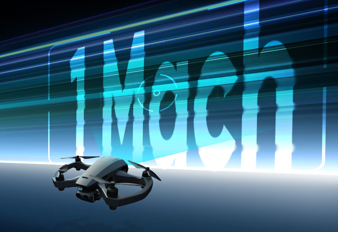
Compensating for such vibrations in real time requires an extremely high sampling rate from the altitude sensor. The Benewake TF-A300 delivers a 10,000 Hz sampling rate, capturing high-frequency tremors that are invisible to the naked eye.
This high sampling rate provides high-frequency altitude feedback, allowing the flight controller to adjust thrust more responsively to vertical disturbances, significantly improving image capture success in complex airflow conditions.
Safeguarding Close-Range Operational Safety
1. Collision Risk
During complex drone operations, such as capturing imagery in close proximity to bridge undersides or high-voltage towers, pilots face a dual challenge: maintaining a short distance for high-resolution detail while strictly preventing collisions.
To avoid obstacles, pilots often perform frequent manual flight path corrections. These adjustments result in jerky camera movements and unstable compositions.
Furthermore, abrupt automated obstacle-avoidance maneuvers can interrupt burst-shooting sequences or video recording.
2. Benewake LiDAR Solution
Benewake TFA300 supports a wide range of LiDAR detection from 0.1 to 290 meters, offering exceptional precision at close distances.
By integrating this high-frequency data with the flight control system, the UAV can achieve enhanced hover stability in tight spaces. This not only ensures flight safety but also provides a more stable imaging platform for the camera.
Conclusion
A gimbal stabilizes orientation, while LiDAR improves positional accuracy and consistency. If you are struggling with occasional out-of-focus shots, inconsistent resolution, or risky close-range operations, it is time to rethink your drone sensor suite. For accurate, clear, and high-quality aerial images, Benewake LiDAR is the answer.